Since the revision of the CAP in 2015, when Greening was introduced, the claim form for direct payments has become considerably more complicated. The necessity to record each crop, which was simply not a requirement of the Single Payment scheme is present with the Basic Payment because of the 3-crop rule.
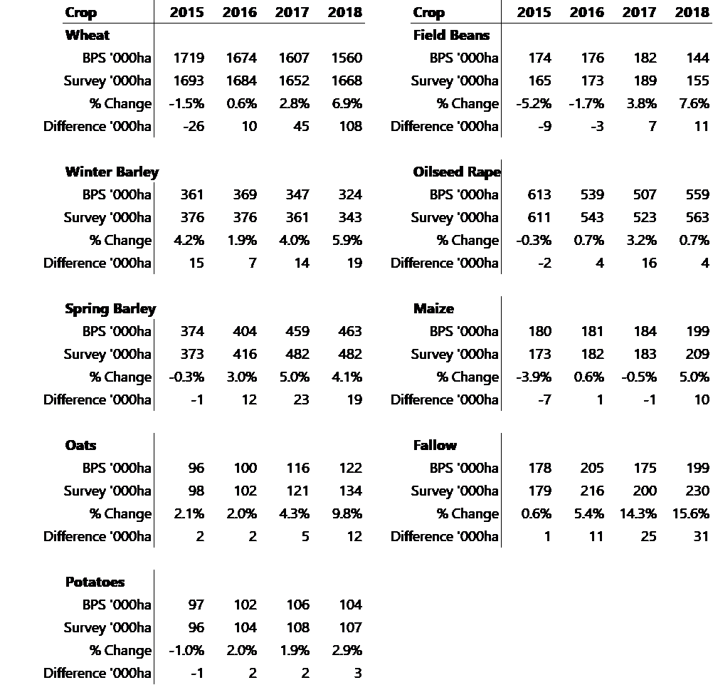
For the second year running, Defra has published a comparison table comparing the June census crop area figures for England against the claimed BPS crop areas. A noticeable difference between the 2 sets of data has emerged, specifically in wheat, with an almost 7% difference in 2018 (BPS lower). This is equivalent to 108,000 hectares which at average yields is over 850,000 tonnes of wheat potentially missing, certainly enough to have a considerable impact on the market, especially as it would shift the UK’s balance from that of a net exporter to net importer. The market reacted with an assumption the survey was incorrect which may not be the case.
Examination of the other crops suggests the differences between the two data sources have increased this year compared with the previous 3 years. As the tables below show, considerable differences of the magnitude experienced in wheat (as a percentage of each other) are also seen in oats, beans and fallow land.

There were no differences to the forms this year, so whilst it is possible that claimants entered field edges and environmental scheme information differently, or entire field versus cropped field areas, one would expect the differences to be consistent year to year. It is barely possible that the different date of each form made any difference (even with the extreme weather conditions) as crops would have been planted for both dates; 15 May and 1 June. Defra is examining the discrepancy and we will report of the outcome when we know it.